
Skip to content
KitploitKITPLOIT
ToolsExploitsBlog
Log in
Einreichen
ToolsExploitsBlog
Einreichen

Hacking-, PenTest- und Cybersicherheits-Tools für Ihr Sicherheitsarsenal!

Kitploit ist ein Verzeichnis von Hacking-, Cybersicherheits- und Pentesting-Tools. Entdecken Sie die neuesten Projekt-Updates, um Schwachstellen zu finden, Systeme zu analysieren, Tests zu automatisieren und Ihre Sicherheit zu stärken.

FeedsKontaktDatenschutz© 2026 Kitploit

Tool-Verzeichnis

Kategorien

Alle Kategorien anzeigen
Loading categories
gods-eye-view — Ein Spionagesatelliten-Simulator in deinem Browser, nur dass die Daten real sind. Live Open-Source-Raumfahrtaufklärung auf einem fotorealistischen 3D-Globus. | Kitploit
Tools/GitHubGitHub/bilawalsidhu/gods-eye-view
Allgemeine DienstprogrammeOSINT (Open-Source-Intelligence)AufklärungInformationsbeschaffung
GitHubbilawalsidhu/gods-eye-view

gods-eye-view

Ein Spionagesatelliten-Simulator in deinem Browser, nur dass die Daten real sind. Live Open-Source-Raumfahrtaufklärung auf einem fotorealistischen 3D-Globus.

Repository anzeigen
51.6k10.4k445vor 6 TagenVon Kitploit geprüft
Webseite

Beliebteste

Alle anzeigen →

Entdecken Sie die meistgenutzten Tools unserer Community.

Alle Tools erkunden

Durchsuchen Sie unsere Tool-Sammlung

Alle Tools anzeigen →
Teilen
Inhalt in der angeforderten Sprache nicht verfügbar. Englische Version wird angezeigt.

🌐 God's Eye View

CI Reached #1 on GitHub Trending

A spy-satellite simulator in your browser — then you realize the sources are public and the data is real.

Photorealistic 3D globe. Live aircraft, ships, satellites, earthquakes, traffic, and public cameras. Hands-free voice control powered by a realtime AI agent.

No place left behind.
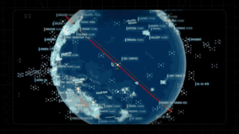
Orbital HUD, a tracked live globe, FLIR terrain — then OPEN SOURCED

The God's Eye View video series on YouTube

▶️ From the project behind the viral God's Eye View series (formerly WorldView) — 5M+ on YouTube · 25M+ across socials

🏆 Reached #1 on GitHub Trending, daily and weekly · August 2026

#8 Product of the Day · Hunted by Chris Messina, creator of the hashtag

“pretty cool” — Brendan Eich, creator of JavaScript and co-founder of Mozilla and Brave · Featured on Pinokio

⚡ Start without API keys. Install with Pinokio or run locally from the terminal. Add optional keys inside the app. → Quick Start


Quick Start · First Five Minutes · Talk to It · What's Live · Under the Hood · Keys & Costs · Contributing


🌍 Why This Exists

God's Eye View brings public signals into one explorable globe. Track the world live. Talk to it. Break it. Extend it.

Flight transponders, ship beacons, orbital elements, seismographs, and public cameras already tell us a lot about the world. God's Eye View puts them in the same place, so you can move between a global picture and an individual aircraft, ship, or street. It runs locally in your browser, with source code you can inspect and extend.

Half the magic is that it looks like a forbidden cockpit. The other half is that every line of code is inspectable.

Most feeds are live or regularly refreshed. Traffic is simulated along real roads using aggregate location data. CCTV camera poses and rocket launch trajectories are coarse estimates.

Start with the included data sources, then add your own. Each layer is a separate module.


🎛️ What This Thing Does

  • 🛩️ Cockpit view: Ride inside a tracked flight — the camera holds the terrain under you all the way down.
  • 📡 Contacts: A 250 km roster of everything near your target — step through live aircraft and drop into any cockpit.
  • 🎯 Click-to-track anything: Camera locks on, draws a fading trail, surfaces full metadata — and a tracked fire or vessel hands you off to the nearest live camera in one click.
  • 🖊️ Voice whiteboard: Speak annotations onto the world — real boundary polygons, marks, and routes.
  • 🛫 3D hangar: Real per-class aircraft models — 787, ATR-72, Citation, Bell 206, MQ-9 — and a tracked contact swaps from glyph to 3D model as you close in.
  • 🎨 Reskin reality: GLSL sensor looks over the normal globe — CRT, NVG, FLIR/thermal, Noir, Snow.
  • 🟩 Detection overlay: Screen-space bounding boxes and IDs on everything in view.
  • 🎖️ Military HUD: Tactical heads-up display with intelligence-style telemetry.
  • 🌐 Global Context: Stage the full situational picture with one switch — and get your exact view back when you leave.
  • 🎥 Scene director: Capture cinematic camera tours for clips and demos.
  • 🔗 Share Links: Camera, style, layers, and even one tracked target serialize into a URL — a live target is a handoff, not a bookmark.
  • 🏠 Reset Globe: One control — or one sentence — back to the full Earth.
  • 🌦️ Weather: Animate GFS or ECMWF forecast wind, replay observed radar, satellite clouds and lightning on one timeline, and follow NHC/CPHC cyclone tracks. No key needed.
  • 📷 Mapped ALPR cameras: License-plate-reader camera locations tagged in OpenStreetMap, one city at a time. Locations and tags only; no key needed.
  • 🔭 Satellite passes: Ask by voice when any loaded satellite next rises over you: rise, peak and set times, and whether you can see it.
  • 🔎 Analyst answers: Count, filter and rank satellites, datacenters and dams by voice, alongside flights, ships, fires and quakes; answers say when a feed is stale or on a fallback.
  • 🧭 Tilt and North Up: Switch between straight-down and a 35° oblique, or put north at the top, while a tracked target stays centered.
  • 🔍 Keyless search: Type coordinates or a bundled city or landmark to fly there with no network request; other names use Google when configured, then Photon and Nominatim.
  • 📦 Shareable scenes: Import, preview and share Director scenes as files or bundles, with camera anchors, authored moves and data packs.
  • 🌊 Nepal flood scene: Replay the Bhote Koshi flood: flood path, witness sources and before-and-after imagery (bundled data is non-commercial; see DATA_SOURCES.md).

YouTube video about the God's Eye View open source release

▶️ The full walkthrough of everything below, on YouTube

⚡ Quick Start

Start without an account or API keys. Both paths open the same app with Esri satellite imagery and keyless terrain. OSM is the fallback if Esri is unreachable. Flights, military traffic, satellites, earthquakes, public cameras, radio, and launches are available without keys.

For photorealistic 3D, add a Cesium ion token for eligible personal, non-commercial use, or a Google Maps key for the direct, metered route and Google place search. Provider terms and quotas apply. Add keys through the app's POWER UP panel; Keys & Costs explains the options.

Already installed? Update to the latest version. Older versions query public OpenStreetMap Overpass servers, which now refuse them, so Traffic, Mapped Installations and ALPR stay empty until you update.


Path 1 — One click, no terminal

  1. Install or update Pinokio to 8.2 or later.
  2. Open God's Eye View in Pinokio.
  3. Click Install, then Start.
Tool herunterladen