
Open Source Global Intelligence Platform - Real-Time OSINT Dashboard - A Palantir Alternative - 2nZNHm3Lr9umG3DVrzYwHgktwkuKuJRXqqRqs3ewpump





A real-time global intelligence dashboard that aggregates live flight tracking, CCTV networks, earthquake monitoring, conflict zone mapping, and 24/7 news feeds into a single GPU-accelerated interface.
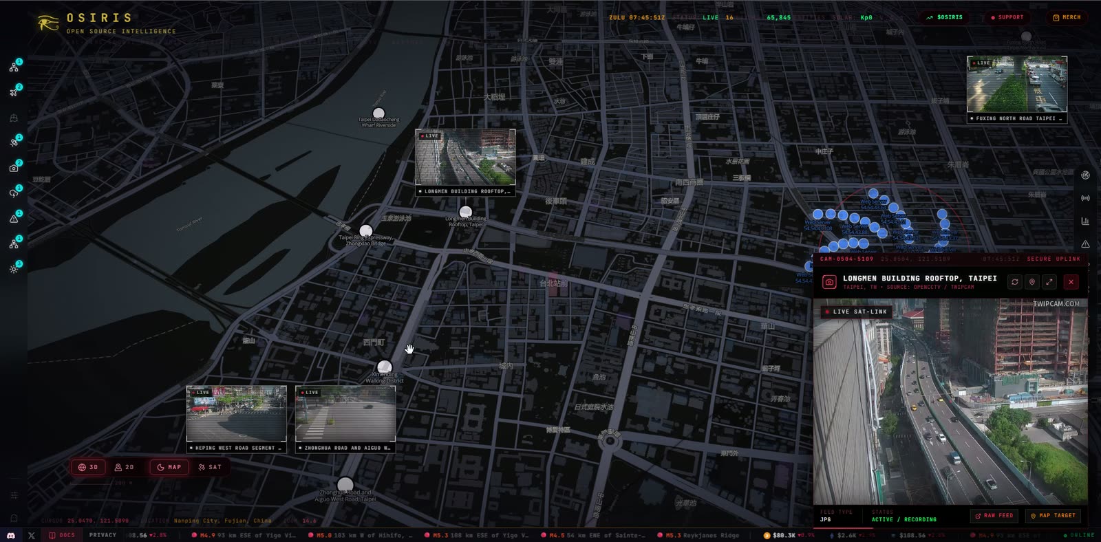
Taiwan — Taipei's public traffic cameras streaming live on the Night map, one feed open full-size
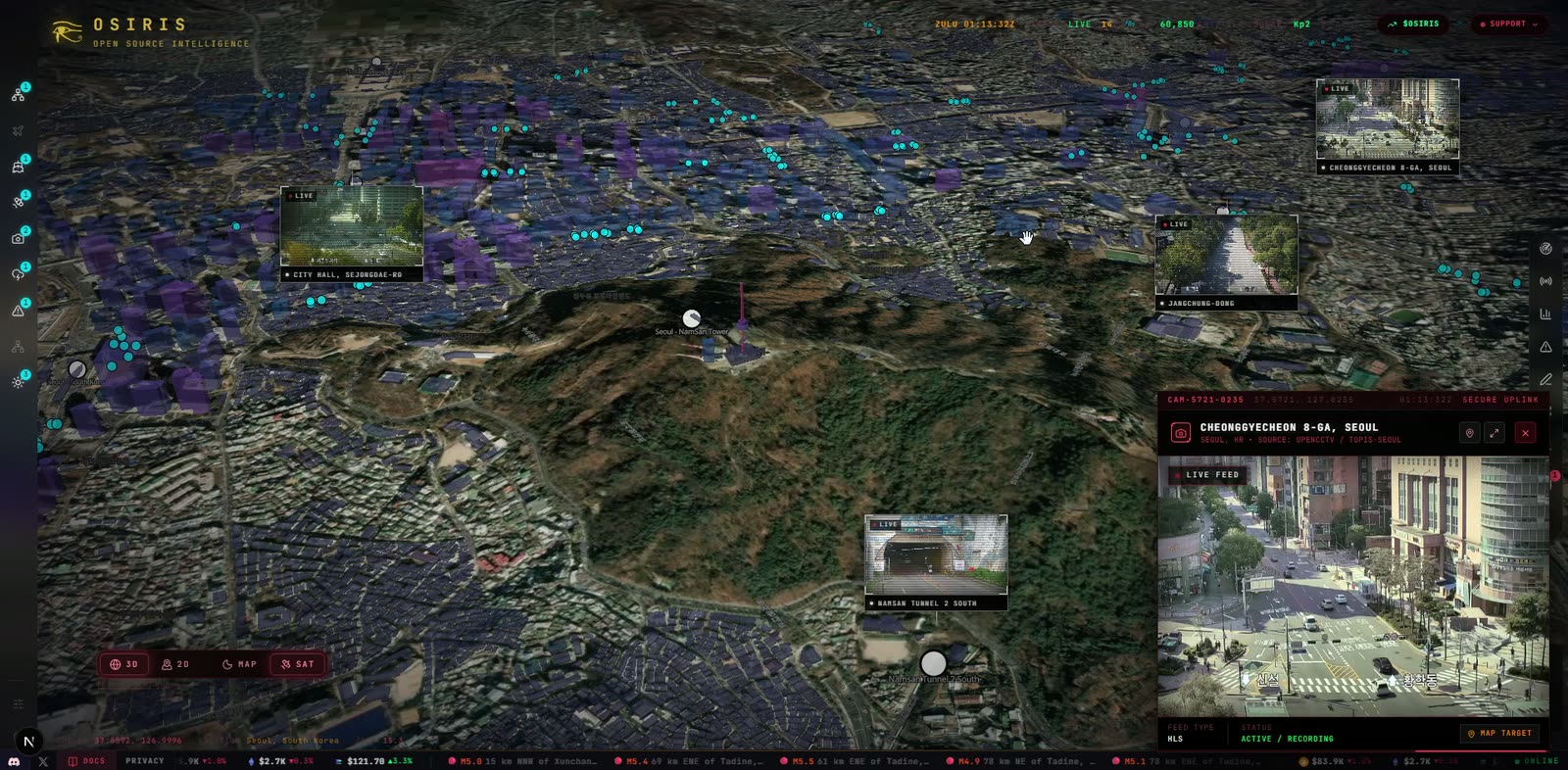
Seoul — live CCTV in 3D terrain around Namsan Tower, with the Cheonggyecheon feed playing
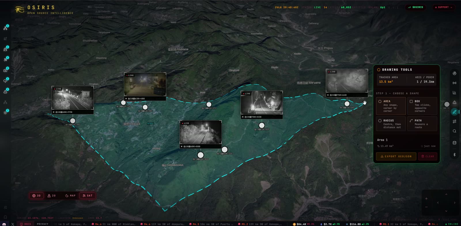
Save an Area — draw a region and OSIRIS finds every camera inside it, ready to export as GeoJSON
Osiris is a production-grade OSINT platform that provides situational awareness across multiple intelligence domains. Built with Next.js 16 and MapLibre GL, every data point is rendered via WebGL for 60fps performance even with thousands of concurrent entities on-screen.
| Domain | Data Points | Sources |
|---|---|---|
| Aviation | Commercial, Private, Military, Jets | OpenSky Network |
| Maritime | 39 Global Ports, 10 Chokepoints | Static Naval Intel |
| CCTV | 17,000+ Cameras | TfL, WSDOT, Caltrans, ODOT, MDOT, HK Transport Dept, Taiwan THB, NZTA, Rijkswaterstaat, Public Webcams + more |
| Seismic | Real-time M2.5+ | USGS Earthquake API |
| Fires | Active Hotspots | NASA FIRMS |
| News | 24/7 Live Streams | 23 Global Broadcasters |
| Weather | Severe Events | NASA EONET |
| Space | Solar Weather, Satellites | NOAA SWPC, N2YO |
| Cyber | CVE Threats, Vulnerability Scanning | NVD, Custom Scanner |
| Conflict | 13 Active Zones | Static OSINT Intel |
| Crypto | BTC + ETH Wallet Tracing, OFAC SDN Match | blockstream.info, Blockscout, OpenSanctions |
| Sanctions | Person / Org / Vessel SDN Search | OpenSanctions (US OFAC SDN mirror) |
| Telegram OSINT | Geoparsed Posts from Public Channels | t.me/s/<channel> web preview |
┌─────────────────────────────────────────────────┐
│                  OSIRIS CLIENT                   │
│  ┌──────────┐  ┌──────────┐  ┌───────────────┐ │
│  │ MapLibre  │  │  HUD     │  │  RECON Toolkit│ │
│  │  GL (GPU) │  │ Panels   │  │  Port Scan    │ │
│  │  WebGL    │  │ Layers   │  │  DNS / WHOIS  │ │
│  │  Render   │  │ Controls │  │  Vuln Scanner │ │
│  └──────────┘  └──────────┘  └───────────────┘ │
├─────────────────────────────────────────────────┤
│               NEXT.JS API ROUTES                 │
│  /api/flights         /api/earthquakes          │
│  /api/cctv            /api/news                 │
│  /api/fires           /api/maritime             │
│  /api/gdelt           /api/satellites           │
│  /api/weather         /api/scanner              │
│  /api/sentinel        /api/telegram-feed        │
│  /api/osint/*  (whois, dns, ip, cve, sanctions, │
│                 crypto, sweep, threats, …)      │
├─────────────────────────────────────────────────┤
│              EXTERNAL DATA SOURCES               │
│  OpenSky · USGS · NASA · NOAA · TfL · NVD      │
│  GDACS · EONET · FIRMS · N2YO · RSS Feeds      │
│  blockstream.info · Blockscout · OpenSanctions  │
│  t.me public previews                            │
└─────────────────────────────────────────────────┘
OI Assist: talk to the map (press O). Ask in words, typed or spoken, and OI flies you there, switches the layers on, finds what is live (flights, military aircraft, ships, quakes, fires, weather, news, cameras, satellites), marks it on the globe in cyan with the area it searched, lists it in cards you can click through, reads the markets, opens panels and starts forecasts, all on your own model key.
OI Forecast: a prediction engine inspired by the community-made Pythia and by MiroFish. From Pythia comes the idea of forecasting from the live world OSIRIS already watches; from MiroFish, the method: cast the actors who shape an outcome and play them against each other in parallel simulated worlds. Ask a question and OI researches it from sources you can check (news, prices, prediction markets and the live feeds), runs the worlds, and has a report agent weigh the result against the crowd's price and a statistical baseline before it writes a calibrated forecast, every claim linked to its source. The whole run plays out on the globe as it happens.
/api/oi with live Server-Sent Events, and an MCP server at /api/mcp so agents such as Hermes, Claude and Cursor can run predictions, steer them and read OSIRIS intelligence. See the docs.Public TxDOT ITS snapshots are integrated with the existing camera markers, preview grid and viewer. Use /api/cctv?region=texas for Texas only; global and Texas location queries include the same source. District inventories are cached independently, with stale data retained during outages. Availability varies by district and camera; these are refreshing JPEG snapshots, not video streams.
Source: TxDOT ITS.