Local Exif Geo Map 📍
A powerful, privacy-focused, browser-based tool to visualize and analyze GPS data from your photos. Simply drag and drop images to generate interactive maps, heatmaps, elevation profiles, and trip statistics.

Why?
I've always wanted a self-hosted tool to analyze my photos and turn them into maps. Then came my Croatian vacation, where the wind decided my hammock was its mortal enemy. At 2 AM, sleep-deprived and slightly windburnt, I retreated to the beach and coded the entire core of this app on my phone like a complete maniac.
It's still a beautiful disaster—powered by sea breeze, insomnia, and questionable life choices. But shockingly, most of it actually works.
All translations besides Bavarian (which I painstakingly did myself, because I'm apparently that specific flavor of weird) were churned out by AI, mostly EuroLLM and Claude. So if German reads like a robot having a stroke, you know why.
📸 Screenshots
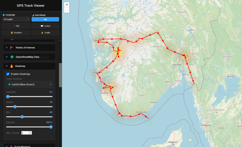 | 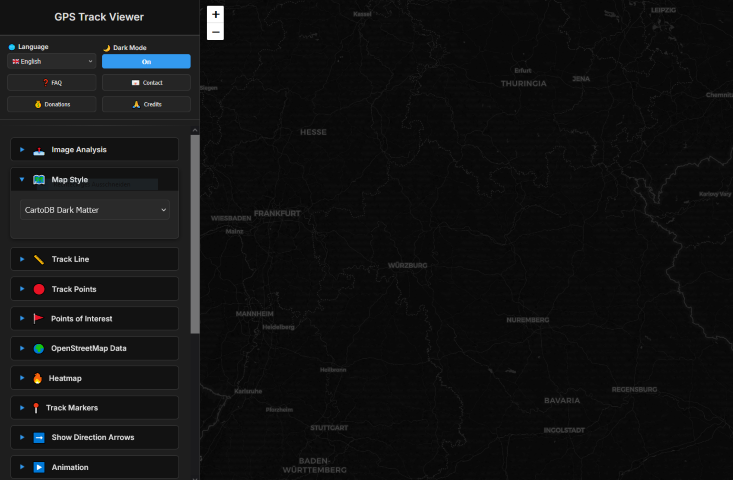 | 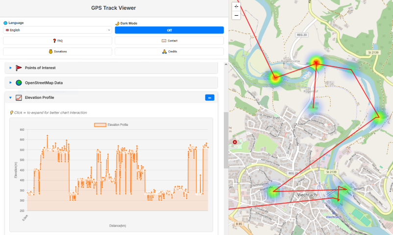 | 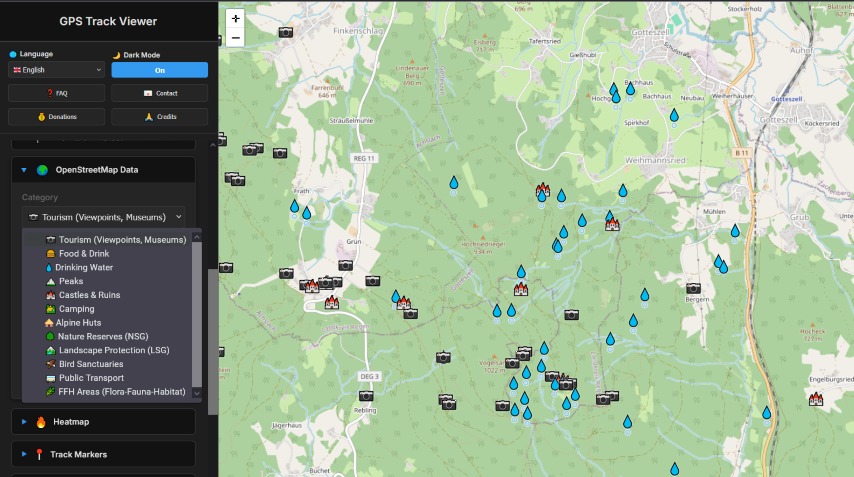 |
|---|
| Interactive Map | Dark Mode | Elevation Profile | Overpass Import |
✨ Features
📷 Image Analysis
- Drag & Drop Upload: Simply drop photos onto the sidebar to extract GPS data
- EXIF GPS Extraction: Automatically reads GPS coordinates, timestamps, and elevation from image metadata
- Orphaned Photo Sync: New! Photos without GPS data are automatically placed on the map if they match the timestamp of an uploaded GPX track (needs to be tested)
- Batch Processing: Handle thousands of images (tested up to 50,000+ photos)
- Progress Tracking: Real-time progress bar during image processing
Interactive Mapping
- 12+ Map Styles: OpenStreetMap, Esri Satellite/Terrain, CartoDB (light/dark/voyager), OpenTopoMap, OPNV (transport), OpenRailwayMap, and more
- Track Customization:
- Line Style: Solid, Dashed, or Dotted lines
- Visuals: Adjustable line color, thickness, and opacity
- Track Points:
- Markers: Custom shapes (circle, square, star, etc.), colors, sizes, and borders
- Timestamps: Toggle permanent timestamp labels for every point
- Direction Arrows: Visualize movement direction with adjustable size/spacing
- Auto-Follow: "Follow Mode" keeps the map centered on your position during playback
📍 Points of Interest & OpenStreetMap Data
- POI Editor: Click anywhere on the map to add custom waypoints with names and descriptions
- OpenStreetMap Data: Load nearby POIs directly from Overpass API (with "Server Busy" handling):
- Tourism: Viewpoints, Museums, Hotels, Hostels, Information Centers, Attractions
- Food & Drink: Restaurants, Cafes, Fast Food, Bars, Pubs, Biergartens
- Water: Drinking Water, Springs
- Peaks: Mountain Peaks (with elevation in meters)
- Historic: Castles, Ruins, Monuments, Memorials, Archaeological Sites
- Nature: Camping, Huts, Nature Reserves (NSG), Landscape Protection (LSG), Bird Sanctuaries (VSG), FFH Areas
- Transport: Bus Stops, Train Stations
- Info Boxes: Click any POI to see details:
- Name & Type
- Elevation (if available)
- Website Links
- Wikipedia Links (auto-detected languages)
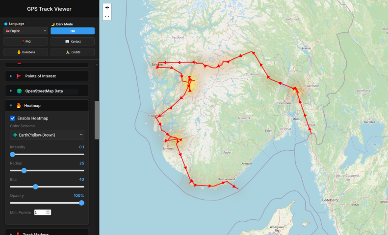
🔥 Heatmap
- Density Visualization: See where you spent the most time
- 5 Color Schemes: Fire, Cool, Earth, Marine, Twilight
- Adjustable Parameters: Intensity, radius, blur, and opacity
📈 Elevation Profile
- Interactive Chart: Click on chart to highlight position on map and see exact statistics
- Zoom & Pan: Chart.js powered interactive elevation graph
- Statistics: Global Elevation gain/loss, min/max elevation
- Responsive: "Jump to Elevation Profile" link and expandable sidebar for detailed analysis
▶️ Animation
- Playback Controls: Play/pause your journey over time
- Adjustable Speed: 0.5x to 5x playback speed
- Follow Mode: Camera automatically follows current position
- Trail Effect: Visual path history during playback
📊 Statistics
- Total Distance: Calculated track length in km
- Duration: Time span from first to last photo
- Average Speed: Movement speed calculation
- Point Count: Number of GPS points from images and tracks
📅 Timeline
- Chronological View: See all track points ordered by time
- Jump to Position: Click timeline entries to navigate on map
💾 Export Options
- PNG Export: One-click download of the current map view as a high-quality PNG image (including all active layers, heatmaps, and markers)
- GPX Export: Export your analyzed photo track as a standard GPX file compatible with Strava, Garmin, Komoot, and Google Earth
- Backup: Save your curated map data for later use
🌐 Multi-Language Support
11 languages supported:
- 🇬🇧 English
- 🇩🇪 Deutsch
- 🇮🇹 Italiano
- 🇭🇷 Hrvatski
- 🇵🇱 Polski
- 🇪🇸 Español
- 🇺🇦 Українська
- 🇳🇱 Nederlands
- 🇸🇪 Svenska
- 🇳🇴 Norsk
 Bayerisch
🎨 UI/UX
- Dark Mode: Toggle between light and dark themes (dark by default)
- Responsive Design: Works on desktop and mobile browsers
- Collapsible Sections: Organize sidebar with expandable panels
- Toast Notifications: User-friendly feedback messages
🔒 Privacy First
Your photos never leave your device!
All GPS extraction and processing happens entirely in your browser. No images are uploaded to any server. The only network requests are:
- Loading map tiles (from tile providers like OpenStreetMap)
- Optional: Loading OSM POI data (from Overpass API)
This means your personal photos and location data remain 100% private.
Also, there is no logging at all from the app.
🛠️ Technologies
📦 Installation & Usage
Requirements
- PHP 8.2 or higher
- A modern web browser (Chrome, Firefox, Safari, Edge)
Installation
- Clone the repository (or download as ZIP and extract)
- Configure your web server point to the
public/ directory
Deployment
For production use, deploy to any PHP-capable web server (Apache, Nginx with PHP-FPM, etc.)
📁 Project Structure
 lukawe/localexifgeomap
