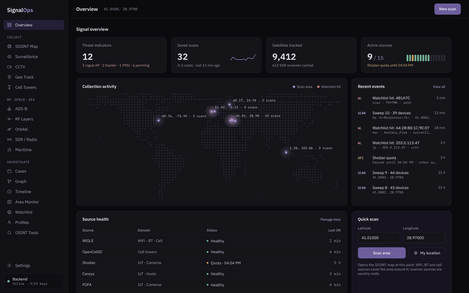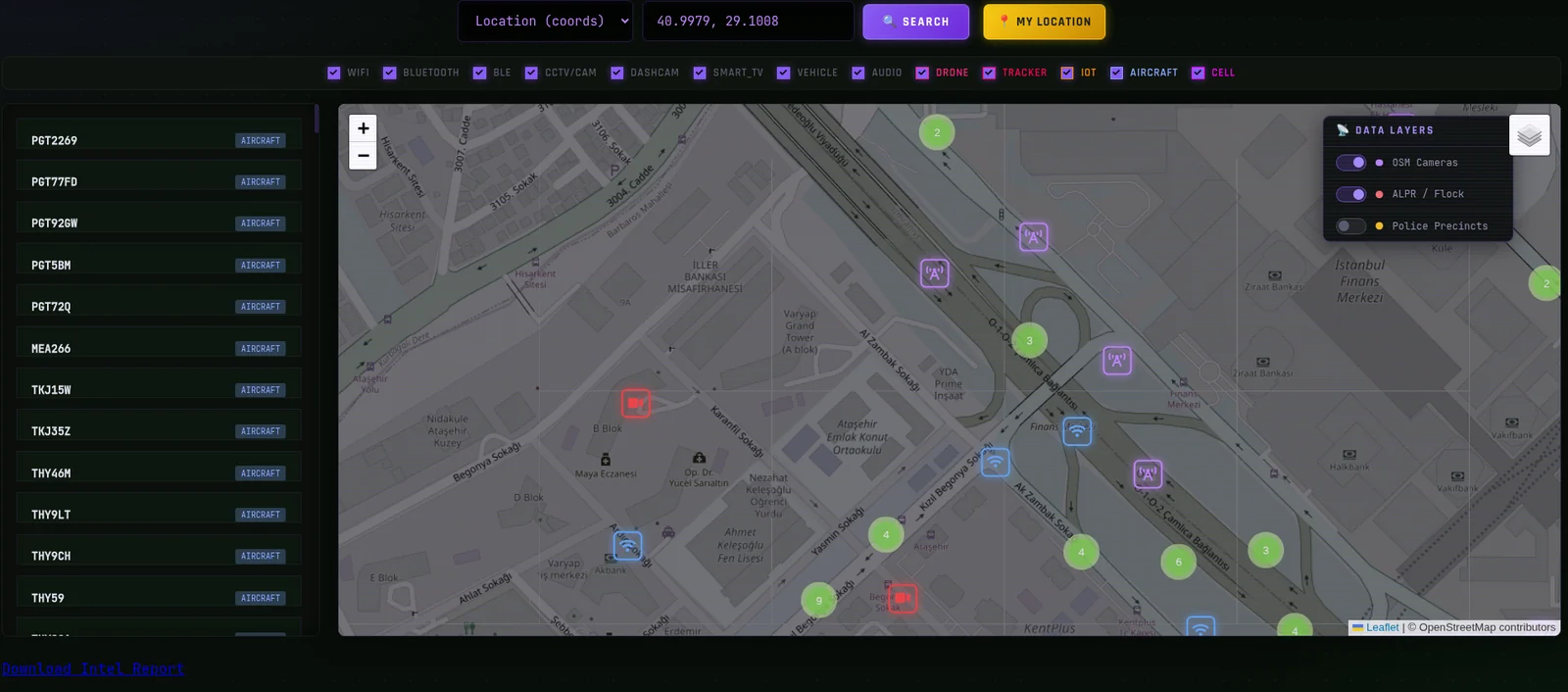

All-source intelligence fusion dashboard — WiFi, cellular, CCTV, ADS-B, orbital & SDR feeds unified into a single tactical map. Security research only.
A full-spectrum, all-source signal intelligence fusion platform for security research and training. Signal OPS pulls dozens of open collection sources — WiFi/Bluetooth/cell-tower databases, internet-exposure scanners, camera indexes, ADS-B flight feeds, satellite TLE tracking, and SDR/APRS networks — into a single tactical map and Flask API, correlating the RF, cellular, airspace, orbital, and surveillance domains into one real-time operational picture, with optional AI-assisted threat summaries layered on top.
Almost every source is optional. If a key isn't set, that fetcher is skipped gracefully — the free sources (OpenStreetMap, Insecam, ipinfo.io, ADS-B, CelesTrak, KiwiSDR) work with no keys at all.
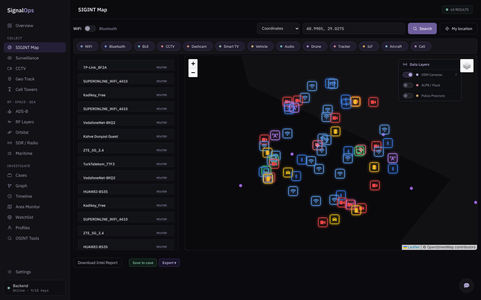
The main map fuses WiFi, Bluetooth, cell, camera, and aircraft layers over the same area, with toggleable overlays for OSM cameras, ALPR/Flock networks, and police precincts.


| Surveillance feed | CCTV discovery |
|---|---|
![]() | ![]() |
The surveillance list scores each device (e.g. "Suspicion 35/100: Unauthenticated camera") and merges routers, TVs, and exposed cameras from WiGLE, Insecam, and OSM. The CCTV view groups discovered cameras by source with per-camera risk and live/metadata status.
| Cell tower heatmap | SDR / APRS network |
|---|---|
![]() | ![]() |
Core dependencies:
flask
requests
python-dotenv
Recommended (enables full functionality — caching, rate limiting, satellite propagation):
cachetools # bounded geo-cache (falls back to an unbounded dict if missing)
flask-limiter # request rate limiting
sgp4 # satellite position propagation for /api/satellites
google-genai # Gemini AI analysis (only if you use GEMINI_API_KEY)
Install everything:
pip install flask requests python-dotenv cachetools flask-limiter sgp4 google-genai
git https://github.com/emrekybs/signalops.git
unzip signalops-v1.zip
python -m venv venv
source venv/bin/activate # Windows: venv\Scripts\activate
pip install -r requirements.txt
If you don't have a requirements.txt, use the pip install line from the Requirements section above.
Copy the example file and fill in the keys you have:
cp .env.example .env
Then open .env and paste in your API keys. Every key is optional — leave any line blank (or delete it) to disable that source. See the next section for what each one does and where to get it.
For instant, offline camera and precinct lookups, place these under a data/ directory (or point DATA_DIR elsewhere):
data/CAMERAS_WITH_NETWORK_DATA.geojson # Point features (cameras)
data/police_precincts_usa.geojson # Polygon features (US precincts)
data/camera_networks.json # network-sharing metadata
data/tiles/{z}/{x}/{y}.json # optional tiled camera dataset
If these files are absent, the app automatically falls back to live OpenStreetMap Overpass queries.
python app_v2.py
The server starts on http://0.0.0.0:8080. Open http://localhost:8080 in your browser.
Check which providers loaded successfully at any time:
GET /api/status # active vs. missing keys
GET /api/debug # per-key boolean + live WiGLE auth test
Create a .env file in the project root. Below is the full list read by the app.
These need no configuration: OpenStreetMap Overpass, Insecam, EarthCam, ipinfo.io, ADS-B (adsb.fi / OpenSky), CelesTrak TLE, SatNOGS, and KiwiSDR.
.env.exampleSave this as .env.example in your repo so others know the format:
# ── Signal OPS environment ──
# Every key is optional. Leave blank to disable that source.
# WiFi / Bluetooth / Cell
WIGLE_API_NAME=
WIGLE_API_TOKEN=
OPENCELLID_API_KEY=
# Internet-exposure scanners
SHODAN_API_KEY=
CENSYS_API_ID=
CENSYS_API_SECRET=
ZOOMEYE_API_KEY=
FOFA_EMAIL=
FOFA_API_KEY=
HUNTERHOW_API_KEY=
NETLAS_API_KEY=
LEAKIX_API_KEY=
CRIMINALIP_API_KEY=
BINARYEDGE_API_KEY=
# Cameras & IP reputation
WINDY_API_KEY=
ABUSEIPDB_API_KEY=
# Aircraft & ham radio
ADSB_API_KEY=
APRS_FI_KEY=
# AI analysis
GEMINI_API_KEY=
GEMINI_MODEL=gemini-2.0-flash
# App config
DATA_DIR=./data
FLASK_SECRET_KEY=
A selection of the endpoints exposed (see the source for the full set):
| Variable | Provider | Get a key at |
|---|
WIGLE_API_NAME | WiGLE (WiFi/BT/cell) — username | https://wigle.net/account |
WIGLE_API_TOKEN | WiGLE — API token | https://wigle.net/account |
OPENCELLID_API_KEY | OpenCellID (cell towers) | https://opencellid.org |
SHODAN_API_KEY | Shodan (exposure / cameras) | https://account.shodan.io |
CENSYS_API_ID | Censys — API ID | https://search.censys.io/account/api |
CENSYS_API_SECRET | Censys — API secret | https://search.censys.io/account/api |
ZOOMEYE_API_KEY | ZoomEye | https://www.zoomeye.org/profile |
FOFA_EMAIL | FOFA — account email | https://fofa.info |
FOFA_API_KEY | FOFA — API key | https://fofa.info |
HUNTERHOW_API_KEY | Hunter.how | https://hunter.how |
NETLAS_API_KEY | Netlas | https://netlas.io |
LEAKIX_API_KEY | LeakIX | https://leakix.net |
CRIMINALIP_API_KEY | CriminalIP | https://www.criminalip.io |
BINARYEDGE_API_KEY | BinaryEdge | https://www.binaryedge.io |
WINDY_API_KEY | Windy Webcams | https://api.windy.com/keys |
ABUSEIPDB_API_KEY | AbuseIPDB (IP reputation) | https://www.abuseipdb.com/account/api |
ADSB_API_KEY | adsb.fi (optional; works without) | https://adsb.fi |
APRS_FI_KEY | APRS.fi (ham radio stations) | https://aprs.fi/page/api_key |
GEMINI_API_KEY | Google Gemini (AI analysis) | https://aistudio.google.com/apikey |
| Variable |
|---|
| Default |
|---|
| Description |
|---|
GEMINI_MODEL | gemini-2.0-flash | Gemini model used for analysis |
DATA_DIR | ./data | Directory for local GeoJSON/JSON datasets |
FLASK_SECRET_KEY | random per run | Flask session secret; set a fixed value in production |
| Endpoint | Purpose |
|---|
GET /nearby?lat=&lon=&mode= | Unified RF/OSINT scan around a point |
GET /api/cctv?lat=&lon= or ?country= | Camera discovery by location or country |
GET /api/search?type=&query= | Search by SSID, IP, location, or country |
POST /api/analyze | AI summary of a device list |
GET /api/ip-intel?ip= | Multi-source IP threat intelligence |
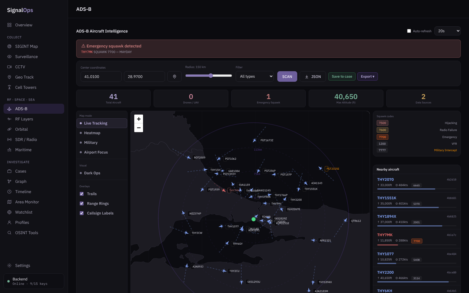
GET /api/adsb?lat=&lon=&radius= | Live aircraft + emergency detection |
GET /api/satellites?categories= | Satellite positions (TLE + SGP4) |
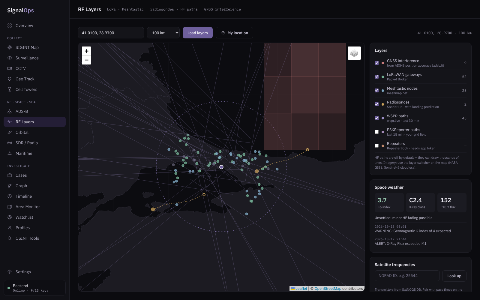
GET /api/gps-jamming?lat=&lon= | GPS-jamming heatmap from ADS-B |
GET /api/sdr/kiwisdr | Public KiwiSDR receiver list |
GET /api/aprs/stations?lat=&lon= | Nearby APRS stations |
GET/POST /api/watchlist | Manage tracked identifiers |
POST /api/watchlist/check | Check a device list against the watchlist |
GET /api/status · GET /api/debug | Provider health / key diagnostics |